Major Typhoon Shanshan May Bring Massive Destruction to Japan
Typhoon Shanshan Update: 11:28 PM Tuesday, August 27, 2024 Japan Standard Time (JST)
Typhoon Shanshan (11W) has become a major concern in the northwest Pacific as it continues to churn near Japan. Classified as a powerful typhoon, Shanshan has reached impressive wind speeds, with forecasters keeping a close watch on its future path and potential impacts.
Here’s a breakdown of the current status of Typhoon Shanshan and what to expect in the coming days.
Powerful Typhoon Shanshan’s Location and Strength
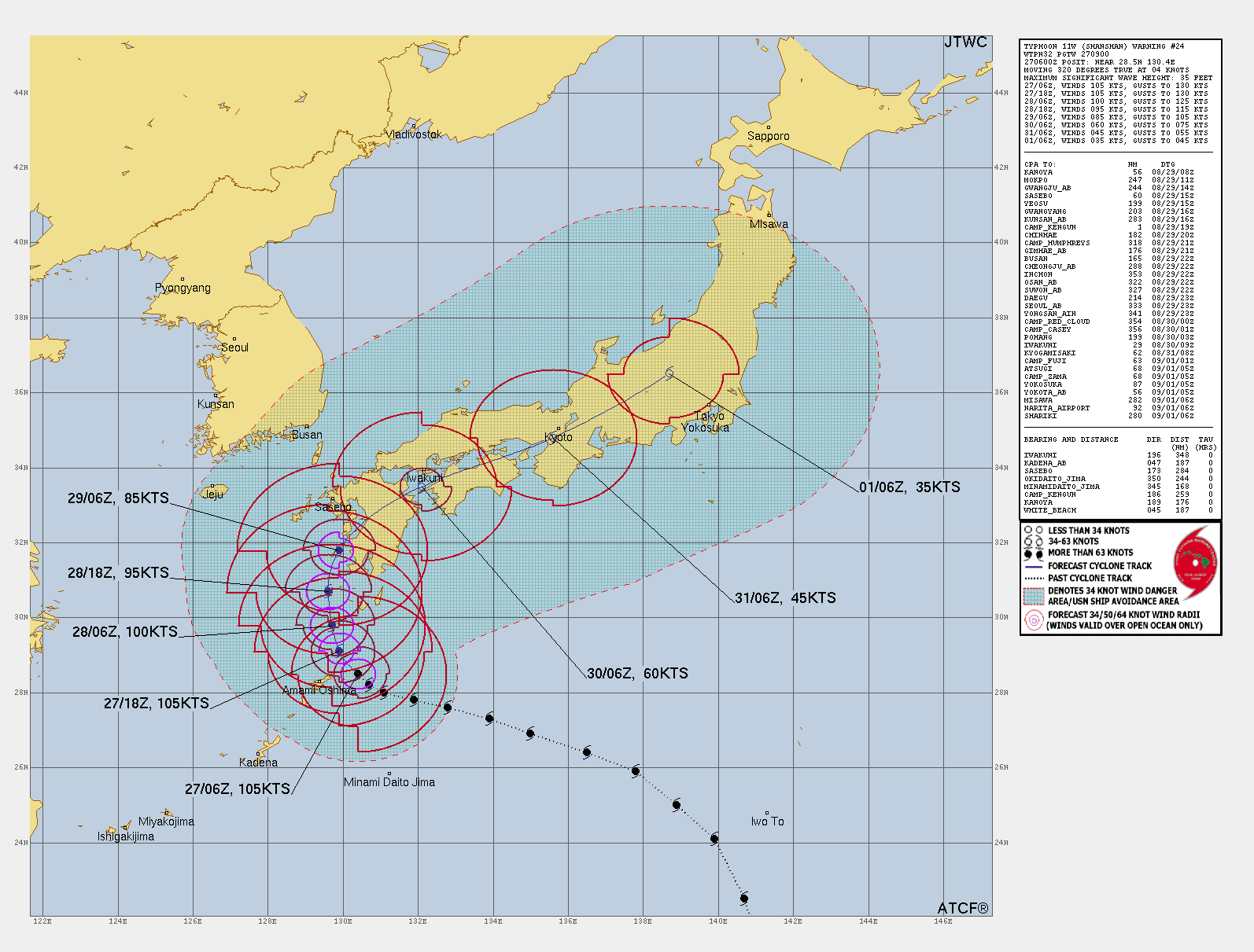
As of the latest update from the Joint Typhoon Warning Center (JTWC) at 1500 UTC on August 27, 2024, Typhoon Shanshan was located near latitude 28.6N and longitude 130.3E, approximately 272 nautical miles south of Sasebo, Japan.
“Shanshan is currently moving slowly, with a northwestward trajectory at just 1 knot (1.9 km/h), and this sluggish movement is expected to continue for the next 24 to 48 hours.”
According to JTWC, Typhoon Shanshan (2024) has maximum sustained winds of 110 knots (203 km/h), with gusts reaching up to 135 knots (250 km/h). The typhoon’s central pressure has dropped to 937 millibars, further emphasizing its intensity.
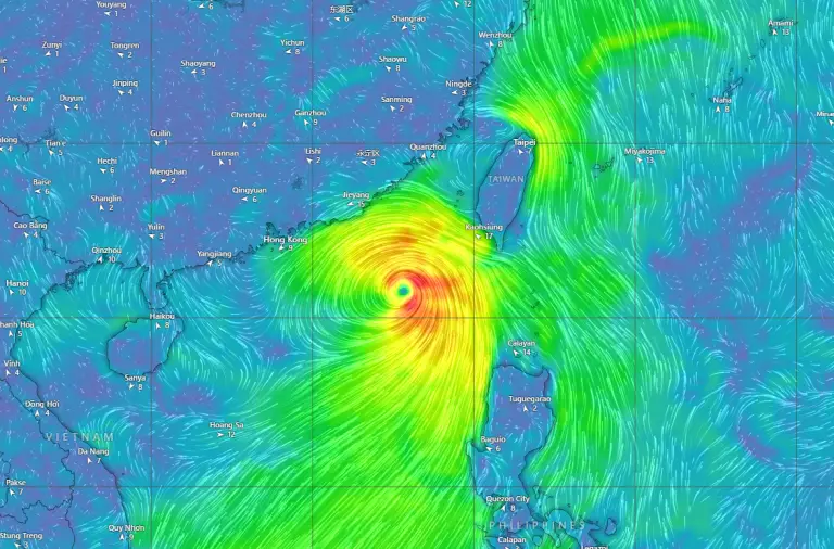
Shanshan’s eye has been clearly visible on satellite imagery, although it has undergone an eyewall replacement cycle recently, resulting in some slight weakening.
Wind Distribution and Impact Radius of Shanshan
The current wind distribution associated with Typhoon Shanshan indicates that it remains a significant storm over open water:
-
Maximum sustained winds of 110 knots extend outward 25 nautical miles in all quadrants.
-
50-knot winds (92.6 km/h) reach 45 nautical miles in the northeast quadrant, 40 nautical miles in the southeast quadrant, and 35 nautical miles in both the southwest and northwest quadrants.
-
34-knot winds (63 km/h) cover an area of 125 nautical miles in the northeast and southeast quadrants and about 85 to 95 nautical miles in the southwestern and northwestern quadrants.
These wind radii demonstrate the broad reach of Typhoon Shanshan, even though it is still confined to open water. As it approaches land, these wind fields may bring significant storm impacts to coastal areas of Japan.
Typhoon Shanshan Forecast for the Next 72 Hours
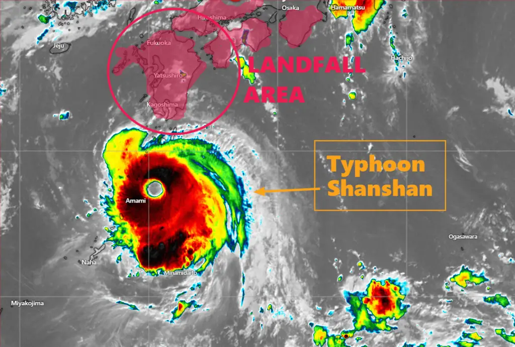
Over the next 12 to 24 hours, Typhoon Shanshan is expected to maintain its current intensity. Forecasts from JTWC suggest that the typhoon will track northward at a slow pace, eventually moving closer to Kyushu and Shikoku, two of Japan’s main islands.
*In the next 12 hours, Typhoon Shanshan is forecast to maintain maximum sustained winds of 110 knots, with gusts up to 135 knots. The storm’s wind field will remain strong, with tropical storm-force winds extending farther into open waters.
*By 24 hours, Shanshan’s maximum sustained winds may drop slightly to 105 knots (194 km/h) as it begins to feel the effects of vertical wind shear and interactions with Japan’s landmass. The storm is predicted to be positioned near latitude 30.2N and longitude 129.8E, continuing its slow track northward.
*After 36 to 48 hours, the typhoon will continue to weaken gradually. Maximum sustained winds could drop to 95 knots (176 km/h) by 48 hours as Shanshan interacts with the mountains and rugged terrain of Japan’s islands. Closest approach to Kyushu is very likely.
Extended Forecast and Potential Impact on Japan by Major Typhoon Shanshan
By 72 hours, Typhoon Shanshan is forecast to weaken to 60 knots (111 km/h) with gusts of 75 knots (139 km/h) by making landfall to Kyushu and Shikoku.
As the storm weakens further, it will begin to turn more northeastward, likely tracking across Honshu. The storm’s intensity will decrease significantly as it continues to interact with Japan’s landmasses.
The long-range forecast indicates that Shanshan could continue to weaken to 45 knots by 96 hours as it moves into the Sea of Japan or closer to the eastern coast of Japan. The storm may dissipate entirely or transition into a weaker post-tropical system within five days.
Learn: How to Predict a Tropical Cyclone? Best Tips for Cyclone Prediction
Check Latest Update Here: Global Weather
Factors Affecting Typhoon Shanshan’s Path
Several environmental factors will influence Typhoon Shanshan’s future track and intensity:
1. Vertical Wind Shear: Shanshan has been battling moderate vertical wind shear (20-25 knots) from the north, which could gradually weaken the system as it approaches Japan.
2. Sea Surface Temperatures (SSTs): Despite the wind shear, Shanshan is still over warm waters of 30-31°C, which can help the storm maintain its strength for the next day or two.
3. Eyewall Replacement Cycle: The ongoing eyewall replacement cycle is also contributing to slight fluctuations in intensity, with a new, larger eyewall forming to replace the smaller, deteriorating one.
4. Steering Mechanisms: The typhoon is currently being steered by a subtropical ridge (STR) positioned to its northeast and east.
However, a shortwave trough digging into the Sea of Japan may cause Shanshan to move slower and turn more poleward in the coming days.
Model Guidance and Uncertainty on Typhoon Shanshan Forecast
There remains some uncertainty regarding Typhoon Shanshan’s exact track, particularly beyond 72 hours. Different models offer varying predictions:
1. ECMWF models generally track Shanshan across central Honshu, predicting a more rapid northeastward movement.
2. GFS models, on the other hand, suggest a possible stalling of the storm near Kyushu or Shikoku, leading to slower and more erratic movement.
Given this uncertainty, there is medium confidence in the forecast for the next 72 hours but low confidence beyond that period.
Overall Forecast Outcome of Typhoon Shanshan
Typhoon Shanshan remains a powerful and dangerous system in the northwest Pacific. While its future track and intensity remain uncertain, it is likely to bring strong winds, heavy rainfall, and significant waves to parts of Japan over the next few days.
Those in affected areas should continue monitoring official updates and prepare for potential impacts as the storm approaches.
Advertisements