Tropical Cyclone Vince Latest Update : Strength, Track, and Forecast
As of Tropical Cyclone Vince (13S) latest update, it continues its journey over the open waters of the South Indian Ocean. As of the latest warning issued by the Joint Typhoon Warning Center (JTWC), Vince remains a powerful system, though it is expected to weaken gradually in the coming days. This article provides the latest details on its intensity, track, and forecasted movement.
Current Position and Intensity of Tropical Cyclone Vince
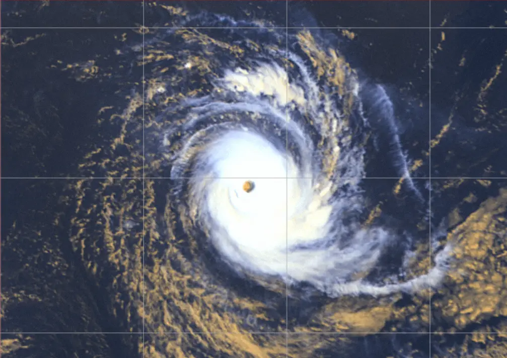
As of 08 February 2025, at 0600Z, Tropical Cyclone Vince was located at 20.3S 74.6E, approximately 1,445 km south-southeast of Diego Garcia. The system is moving west-southwestward at 19 km/h.
-
Maximum sustained winds: 231 km/h
-
Gusts: 278 km/h
-
Minimum central pressure: 935 mb
-
Significant wave height: 50 feet
Wind Distribution:
-
Hurricane-force (119 km/h) winds extend 56-74 km from the center.
-
Storm-force (93 km/h) winds extend 74-111 km.
-
Gale-force (63 km/h) winds extend 111-222 km, with the strongest winds in the southern quadrants.
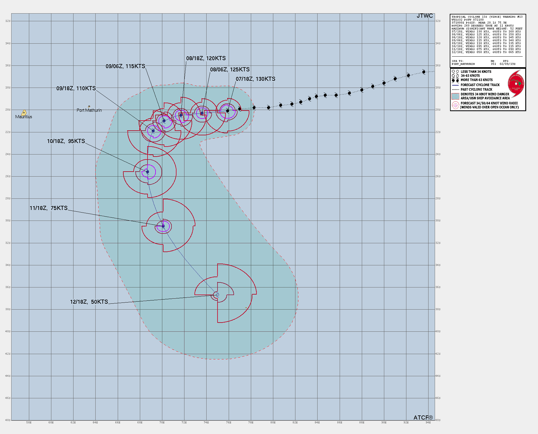
Forecast Track and Intensity Trends of Tropical Cyclone Vince
Over the next 24-48 hours, Vince is expected to continue on a west-southwestward track under the influence of a subtropical ridge. By 72 hours, the system will begin a more southerly turn, gradually weakening as it encounters cooler waters and increased wind shear.
Key Forecast Points:
08 February (12H forecast): 222 km/h, gusting 269 km/h at 20.5S 72.9E.
09 February (24H forecast): 204 km/h, gusting 250 km/h at 21.2S 71.0E.
10 February (48H forecast): 176 km/h, gusting 222 km/h at 23.0S 68.7E.
12 February (120H forecast): 83 km/h, gusting 111 km/h at 38.0S 74.5E (extratropical transition expected).
Environmental Conditions and Future Outlook
Sea Surface Temperatures (SSTs): 26-27°C, gradually decreasing.
Wind Shear: Currently moderate (28-37 km/h), expected to increase significantly after 36 hours.
Upper-Level Outflow: Strong radial outflow, supporting current intensity but likely to diminish soon.
By 72-96 hours, Vince will undergo extratropical transition as it moves into an upper-level trough and cooler ocean temperatures. This process will lead to significant weakening and structural changes, making it more of a hybrid system rather than a purely tropical cyclone.
Potential Impact Areas of Tropical Cyclone Vince
Since Vince is currently over open water, it poses no immediate threat to land. However, strong ocean swells and high waves will impact the South Indian Ocean shipping lanes.
Conclusion of the Forecast
Tropical Cyclone Vince remains a very intense system but is forecast to weaken steadily as it moves westward before turning south. Mariners and weather agencies will continue to monitor its progress. The next official warning update will be issued at 081800Z and 090600Z by the JTWC.
For the latest real-time updates, stay tuned to meteorological agencies and official forecasts.
If You are in an old update, Check new updates here (Click Me)
Advertisements