Tropical Cyclone Alfred Latest Update: Track, Strength, and Forecast
Tropical Cyclone Alfred (18P) continues its movement over the Coral Sea, experiencing structural changes and weakening due to environmental conditions. As per the latest advisory from the Joint Typhoon Warning Center (JTWC), Alfred is expected to shift direction and could potentially impact southeastern Queensland, Australia. This update provides the latest position, intensity, and forecast for TC Alfred.
Current Position and Intensity of Cyclone Alfred
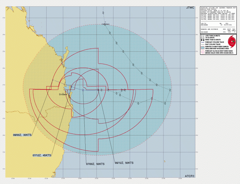
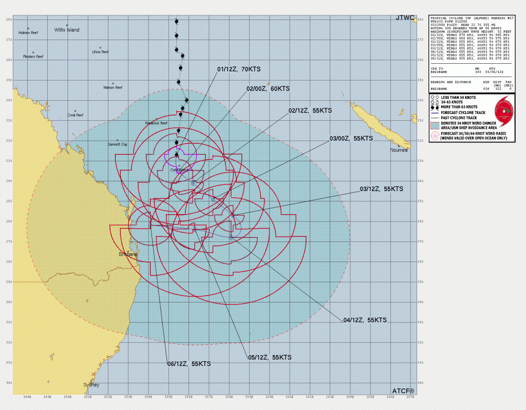
As of March 1, 2025, at 1500Z, Tropical Cyclone Alfred was located at 22.7S 155.4E, approximately 600 km north-northeast of Brisbane, Australia. The system is moving southward at 11 km/h.
- Maximum sustained winds: 130 km/h
- Gusts: 155 km/h
- Minimum central pressure: Estimated around 975 mb
- Significant wave height: 10 meters
Wind Distribution of Cyclone Alfred :
- Hurricane-force (118 km/h) winds extend 55-75 km from the center.
- Storm-force (92 km/h) winds extend 75-110 km.
- Gale-force (63 km/h) winds extend 110-220 km, strongest in the southeastern quadrant.
Current Environmental Conditions
Tropical Cyclone Alfred is experiencing significant changes in structure due to external influences:
- Vertical Wind Shear (VWS): Moderate to strong at 37-46 km/h, pushing convection away from the center.
- Sea Surface Temperatures (SSTs): Warm at 27-28°C, supporting intensity.
- Dry Air Intrusion: Strong mid-level dry air from the southwest is eroding Alfred’s convective structure.
- Outflow: Strong poleward outflow assisting in maintaining intensity temporarily.
Forecast Track and Intensity Trends of the Tropical Cyclone Alfred
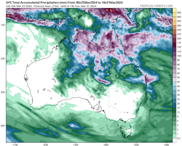
Alfred is expected to continue moving southeastward over the next 48 hours under the influence of a subtropical ridge (STR) to the northeast. After that, a secondary ridge building over southeastern Australia will cause the cyclone to turn westward toward the Queensland coast.
Key Forecast Points in the Tropical Cyclone Alfred Latest Update:
- 02 March (24H forecast): 120 km/h, gusting 145 km/h at 23.5S 154.0E.
- 03 March (48H forecast): 100 km/h, gusting 125 km/h at 25.0S 152.0E.
- 04 March (72H forecast): 85 km/h, gusting 110 km/h at 26.5S 150.0E.
- 05 March (120H forecast): 75 km/h, gusting 95 km/h at 27.5S 148.5E, potentially nearing landfall.
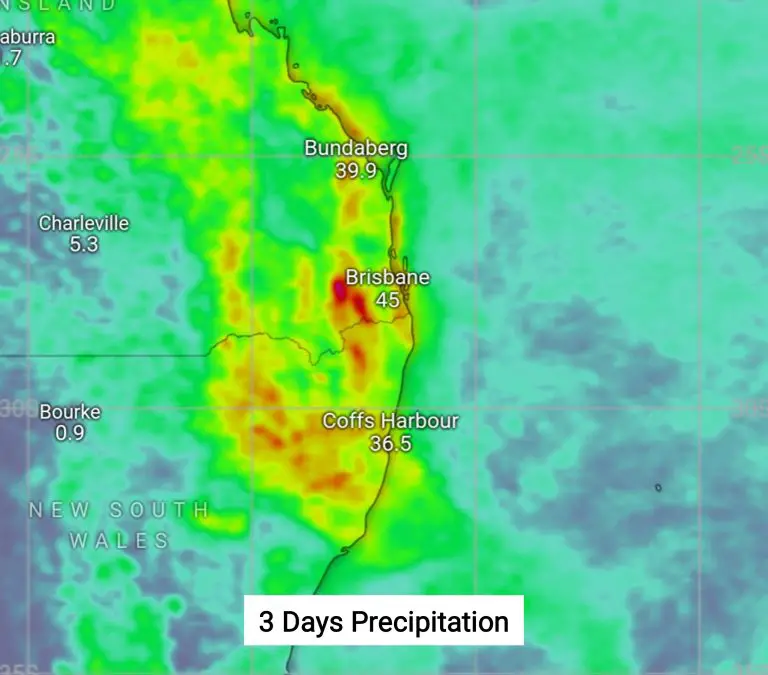
Potential Impact Areas
While Alfred is expected to weaken gradually, it could still bring strong winds, heavy rainfall, and coastal flooding to parts of southeastern Queensland, including Brisbane and Bargara. Due to model uncertainties, the exact landfall location remains unclear.
Model Guidance and Forecast Confidence
- Short-term forecast (0-72 hours): Medium confidence due to consistent model agreement.
- Long-term forecast (72-120 hours): Low confidence due to divergence in track models.
- Intensity forecast: Medium confidence in the weakening trend, but some models suggest a possible slight re-intensification before landfall.
Conclusion Of The Forecast
Tropical Cyclone Alfred remains a moderate-strength system but is encountering adverse environmental factors that will lead to gradual weakening. However, as the system approaches the southeastern coast of Queensland, it could still bring significant impacts. Residents and mariners should stay updated with official warnings from meteorological agencies.
For real-time updates, follow JTWC, Australian Bureau of Meteorology (BoM), and local weather services.
If You are in an old update, Check new updates here (Click Me)
Advertisements