Tropical Cyclone Alfred Latest Update: Landfall Near Brisbane, Australia
Tropical Cyclone Alfred (18P) continues to track toward the Australian coast, maintaining its intensity while exhibiting hybrid characteristics. As of the latest warning from the Joint Typhoon Warning Center (JTWC), Alfred is expected to make landfall near Brisbane within the next 48 hours. This article provides the latest details on its intensity, movement, and potential impact.
Current Position and Intensity of Cyclone Alfred
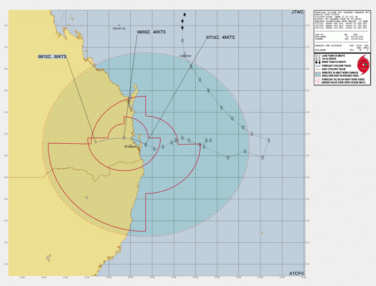
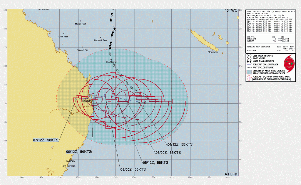
As of March 4, 2025, at 1500Z, Tropical Cyclone Alfred was located at 27.8°S 158.5°E, approximately 540 km east of Brisbane, Australia. The system is moving westward at 11 km/h.
- Maximum sustained winds: 102 km/h (55 knots)
- Gusts: 120 km/h (65 knots)
- Minimum central pressure: Not specified
- Significant wave height: 9 meters (30 feet)
Wind Distribution of Tropical Cyclone Alfred :
- Gale-force (34 kt / 63 km/h) winds extend widely, especially in the southern quadrant.
- Storm-force (50 kt / 93 km/h) winds exist in a small patch within the system.
Forecast Track and Intensity Trends as of Cyclone Alfred Latest Update
Alfred has slowed and shifted westward over the past 12 hours, steered by a subtropical ridge to the south. The storm is expected to continue its westward trajectory, with landfall near Brisbane anticipated within 48 hours.
Key Forecast Points of this Update:
- March 5 (24H forecast): 102 km/h, gusting 120 km/h at 27.5°S 156.0°E.
- March 6 (48H forecast): 102 km/h, gusting 120 km/h at 27.2°S 153.5°E (near Brisbane landfall).
- March 7 (72H forecast): Weakening inland, expected to dissipate.
Environmental Conditions and Future Outlook
- Sea Surface Temperatures (SSTs): 25-26°C, increasing to 26-27°C near landfall.
- Wind Shear: Strong (45-55 knots, reducing to 25-30 knots by landfall).
- Upper-Level Conditions: Poleward outflow remains strong but dry air is affecting the cyclone’s structure.
While Alfred is currently facing strong vertical wind shear and dry air intrusion, a slight intensification is possible just before landfall as the system encounters slightly warmer ocean waters and reduced wind shear.
Potential Impact Areas by Tropical Cyclone Alfred
Cyclone Alfred is expected to bring heavy rainfall, strong winds, and rough seas along the southeastern coast of Queensland, particularly around Brisbane and the Gold Coast. Due to the slow-moving nature of the storm, flooding risks are elevated for coastal and low-lying areas.
Conclusion of the Tropical Cyclone Alfred Latest Update
Tropical Cyclone Alfred remains a moderate-strength system but could intensify slightly before making landfall near Brisbane in the next 48 hours. Coastal residents should prepare for heavy rain, gusty winds, and potential flooding. The system is expected to dissipate within 72 hours after moving inland.
For real-time updates, monitor official forecasts from meteorological agencies and emergency services.
If You are in an old update, Check new updates here (Click Me)
Advertisements