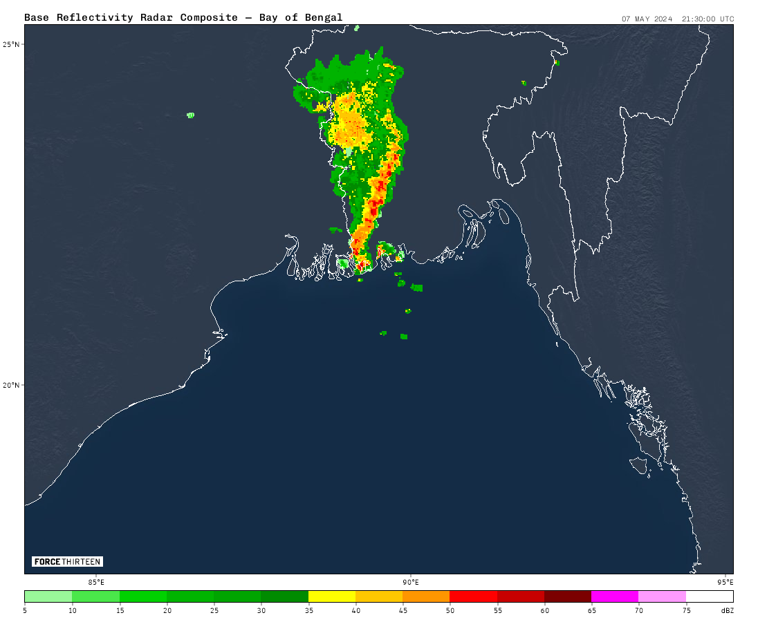
BAF RADAR IMAGE OF BANGLADESH (ONLY AVAILABLE IN BANGLADESH)
BAF Radar (MOSAIC)

BAF Radar (MTR)

BAF Radar (ZHR)

Source: Bangladesh Air Force
Force-13 Radar (F13)

How BAF Weather Radar works?
Weather radar uses radio waves to track precipitation and wind movement in the atmosphere. It works like this:
Sending and Receiving Signals:
Transmission: The radar antenna transmits short pulses of radio waves.
Reflection: These pulses travel through the air and bounce off any objects they encounter, including raindrops, snowflakes, hailstones, and even birds etc.
Reception: The reflected waves travel back to the radar antenna, carrying information about the objects they bounced off.
Extracting Information:
Distance: By measuring the time it takes for the signal to return, the radar can determine the distance to the object.
Intensity: The strength of the reflected signal indicates the intensity of the precipitation or the number of objects reflecting it. Stronger signals suggest heavier rain or hail.
Doppler Effect: Some radars use the Doppler effect to measure the movement of the objects. The frequency of the reflected signal changes slightly depending on whether the object is moving towards or away from the radar, indicating wind speed and direction.
Creating the Image:
Scanning: The radar antenna rotates, sending pulses in different directions to build a 3D picture of the atmosphere around it.
Data Processing: Computers analyze the reflected signals, interpreting the distance, intensity, and movement information to create a map-like image.
Color Coding: Different colors on the map represent different intensities of precipitation or wind speeds.
Limitations:
- Weather radar can be blocked by terrain, so it may not show precipitation behind mountains or tall buildings.
- It can’t differentiate between different types of precipitation like rain, snow, or hail.
- It’s mainly a short-range tool, typically covering a radius of 250km.
By using these principles, weather radar provides valuable information for meteorologists, helping them track storms, issue warnings, and improve weather forecasts.
